More than 8000 digitized maps from the David Rumsey Map Collection are now available for georeferencing. This vast archive, which spans centuries of cartographic history, offers an unparalleled opportunity for history enthusiasts, researchers, and map lovers to dive into the past and contribute to making these historical documents more accessible and valuable.
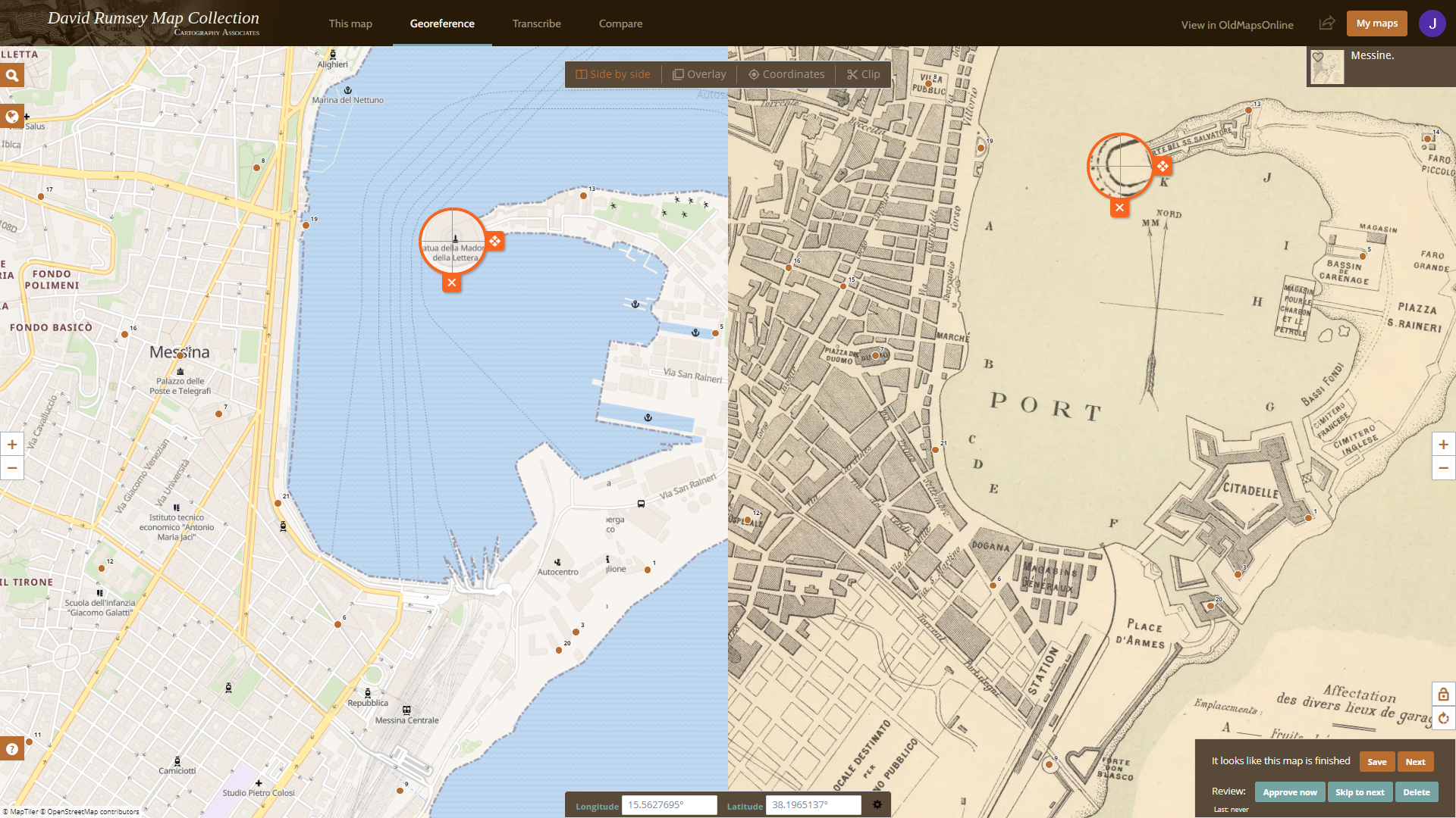
The georeferencing process is user-friendly and intuitive and does not require any special knowledge. Just compare an old map with a modern one, identify and assign points that can be found on both maps, such as street corners, island edges, and other prominent landmarks.
This process transforms scanned old maps into geographically searchable documents, allowing easier comparison with modern maps or other historical maps. It also helps improve the metadata associated with each map, making them more useful for researchers and map enthusiasts.
Join our community and help match scanned historical maps of the David Rumsey collection to the real world, making them more accessible to the public.
For more information about the David Rumsey Map Collection, visit www.davidrumsey.com