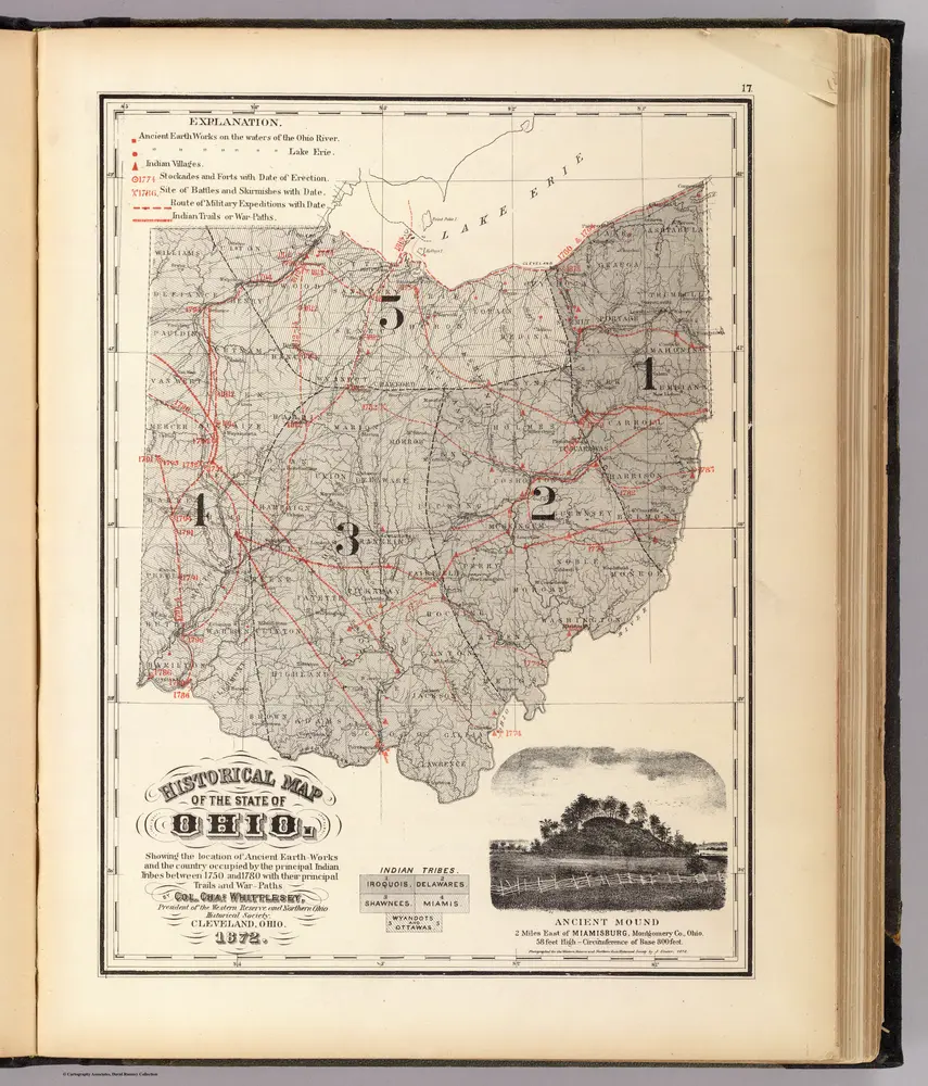
Historical map of the State of Ohio. Showing the location of ancient earth works and the country occupied by the principal Indian tribes between 1750 and 1780 with their principal trails and war-paths by Col. Chas. Whittlesey, President of the Western Reserve and Northern Ohio Historical Society, Cleveland, Ohio, 1872. (with view) Ancient mound 2 miles east of Miamisburg, Montgomery Co., Ohio ... Photographed ... by J. Slater, 1872. (Published by Stedman, Brown & Lyon, Cincinnati. 1872. Entered ... 1872, by H.F. Walling, and O.W. Gray, and H.H. Lloyd & Co. ... Washington)